Friday, 20 February 2015

South Island Road Trip

Gentle Annie's Beach Campground, north of Westport.
While waiting for engine bits to come from England, we busted out, rented a little van and did a little road trip in the Northern part of the South Island.
We drove SW from Nelson out to Westport, then up to Karamea and back south to Greymouth, then headed inland via Reefton and over the Lewis Pass, through Hanmer Springs and popped out on the East Coast at Kaikoura, then looped back to Neslon via Plenheim and Picton.


Cape Foulwind, named by Captain Cook on a bad day.

Gentle Annie Beach, West Coast


Naughtily Feeding the Wekas, Kahurangi Park

Karst landscape at Oparara, Kahurangi Park near Karamea


Not toxic, just tannins in the waterways at Oparara

Don't know what kind. Big.


Denniston was a coal town at the cold, windy and wet top of a mountain north of Wesport, which from the late 1800s until the 60s was home to some very tough coal miners and their families. It's now deserted although there's still a little bit of slowly dying-off coal mining in the area. There is a really great info centre on the site. And a really good site with info: denniston.co.nz

Denniston is 600 m above sea level, so coal was sent down the steep  hill - the Denniston Incline -  and the carts came back up via a counterweighted system of pure Kiwi ingenuity. Sometimes people rode up on the cars though they weren't meant to, but it was a bloody tough walk  - the road didn't go through til the 60s. As you might imagine, sometimes runaway carts caused human carnage on their way down.

Punakaiki Rocks, north of Greymouth. We were caught in a crazy multiple tourbus mob here, but managed to get this photo with no people in it.
Department of Conservation campground near Lewis Pass
Dropping down to the east of Lewis Pass, near Sylvia Flat.

At Kaikoura on the East Coast, where a cold Southerly front blew in like a freight train.
Kaikoura actually means "Crayfish" - there's a few around.
Tramping on the Kaikoura Coast
Tea break at Marfell's Beach, just south of Seddon.


Friday, 6 February 2015

Nelson

 
-->

Entering Nelson


 After months talking about it, we finally pulled into Nelson at the end of January. The city is planted on the southern shores of Tasman Bay, and is known for its summer afternoon sea breezes though the day we motored in from the Abel Tasman the northerlies failed to appear. 

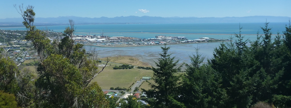
Port Nelson - Marina, commercial docks and the Boulder Bank
A 13-km long boulder bank forms a natural breakwater to the estuary that makes up Nelson’s harbour. The manmade entrance is known as ‘the cut,’ dredged out the early 1900s after the existing harbour entrance had shoaled up to the point of choking out commercial shipping. Once inside, the harbour is mostly quite shallow and so it’s important to mind the channel markers! The shallowness, combined with tides that can range up to four metres, also means that there is a pretty limited mooring and anchorage area available, and so we headed past the commercial fishing and timber-loading docks and into the marina – what a novelty.

On the Boulder Bank, looking East
We had a warm welcome at the dock – our friend and former racing skipper Paul and his wife Deanna were staying in a house above the harbour and had seen us motor into town. They were super-generous over the next few days, driving us around town and showing us the sights.

Paul and Deanna in Kaiteriteri, nothwest of Nelson

Best stall at the country fair
One highlight was a country fair in the Sarau area to the west of Nelson. The area produces lots of blackcurrants, stone fruit and apples, mushrooms, grapes, and hops! The weather was terrible that day but luckily the craft beer was flowing from local producers and the Hops NZ tent was a good spot to get out of the rain.

Nelson lived up to our high expectations. For one thing, the marina is conveniently really close to the town centre and all boating services. There are two excellent local markets each week in town, with local produce and artwork. And there are lots of walking and biking trails through and around the town and westward to the neighbouring towns of Stoke, Richmond, and Motueka.
We hadn’t seen so many bikes on the road since we were home in Victoria! Bike lanes, even! Although we didn’t get to explore them, there were also quite a few mountain biking options nearby.
The weather was amazing while we were there too, just two days with rain during February. Really the only drawback I can think of was the weekly bagpipe band practice half a kilometer up the road from the marina. (Still too close.)

Tasting at the Stoke Brewery in ... Stoke


They take craft beer seriously in Nelson- this is the Church of Beer -- I mean, the Free House, a very genteel pub


Boat projects continued as they always seem to do. This time the transmission was the culprit – specifically the drive plate that interfaces between tranny and engine. 


Left- new drive plate, worth $500.  Right the old one, actually in three separate bits, which held together miraculously til we got into port.
Removing the tranny with background laundry for added glamour
This seeming inconvenience was in reality yet another lucky break, since we’d heard a brief but shocking clacking and grinding noise come from the assembly way back north of Mount Taranaki, on the trip down the West Coast. After a few uneasy seconds there seemed to be no other ill effects at the time, so we thought we might have just chewed through a bit of seaweed or debris. On we motored for about another 120 nm, stopping to anchor twice and then moving slips within the marina – all miraculously it seems because once we had the transmission off the drive plate turned out to be in three separate pieces, plus or minus a few metal shards.  


New plate in place, back of the engine


All fixed up - sea trial out to the Boulder Bank

We repainted the decks too


 All that transmission work involved a lot of waiting around for that expensive part so in the meantime we went on a five-day roadtrip around the top of South Island, stay tuned for some photos!


Wingnuts taking a rest from tramping around town - hey, here tramping just means walking around, no nasty connotations.


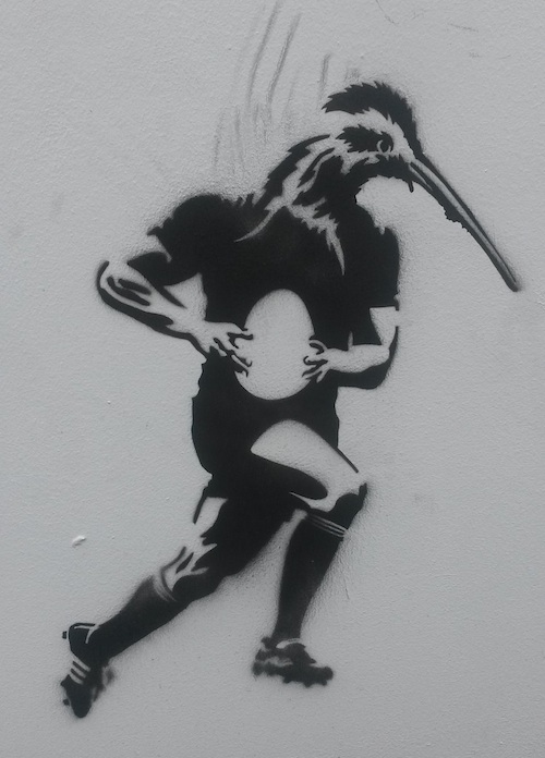
Random Kiwiana graffiti


Saturday, 31 January 2015

Tasman Landfall

"The Anchorage" at Torrent Bay, Abel Tasman National Park, South Island!!
Our first anchorage on the South Island was near Torrent Bay in Abel Tasman National Park -- we'd heard the park was beautiful and reality did not disappoint, although this spot was pretty busy. This is home to one of the country's "great walks" so has a steady stream of trampers passing through and staying in the campsite in the middle of the bay - but in addition there are numerous day trips run into the park from  the closest town, so by mid-day while we were there the beaches were "chockas" with tourists who had arrived via high-speed catamarans. The business certainly didn't bother us on Picara but we did hear some local boaters muttering about how crowded  the bays had become. I guess it's a good thing to make these beautiful places accessible to people who wouldn't necessarily walk the 20 km to get there otherwise....

At Cleopatra's Pools close to Torrent Bay

We also anchored in the park near Adele Island - we arrived there early in the morning and were knocked out by the "dawn chorus" of birdsong as we approached. Later in the day we met some friendly cruisers on the "Leeway": Lainey and Andrew are Nelson locals who have spent years working with Project Janzoon  to trap predatory rats, stoats and possums on the island which is now predator-free. The difference in bird populations between the island and the mainland was striking. They certainly had a lot to eat -- the cicada population was singing out at deafening decibel levels and we were repeatedly bombarded all over our bodies and faces by the big bugs as we tramped along.

Adele Island Anchorage


Bellbird
South Island Robin


Jungly bird haven on Adele Island

Cicada shells on a tree fern stump

The first seal we've seen since leaving Mexico! I nearly stepped on him, he was so sleepy-still and camouflaged.


Sunday, 25 January 2015

Southbound to Nelson

--> It was late January by the time Picara was ready to make her second attempt at sailing 450 nautical miles south to Nelson, and the weather was looking quite benign. We were expecting moderate to strong easterlies for a day or two, and then light winds near the end of the trip; and indeed that’s what we got.

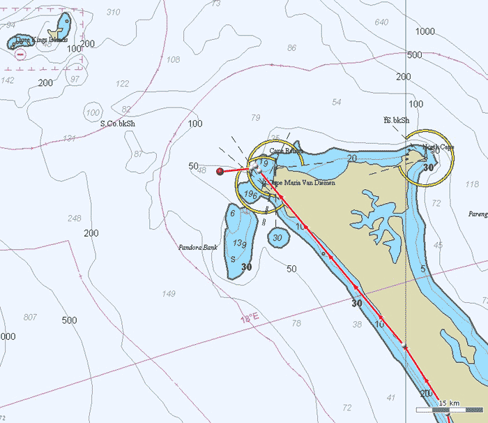
The three capes at the tip of North Island (no that's not our track in red)


We had a sunny day and 20 knots of wind on the beam as we headed north out of Mangonui, and reached North Cape just before dark and just in time to catch enough of the flood tide which carried us around all three capes: North, Reinga, and Maria Van Diemen. There were a few squalls in the dark as we bore off to head eastward across the top of the North Island, but it was all from behind us and running the same direction as the tide which was helping us out by two knots or more at some points, so that we hit 8 and 9 kts of boat speed at some points! This is exciting stuff for Picara as she’s really a 5-knot average kind of girl. It was all the more pleasant because the sea state was quite mellow and the we were dosed up with our “Paihia Bombs,” trademarked seasick pills out of the Paihia Pharmacy which really do the job.

Mike is always a light sleeper and in super-high alert mode when we’re on a coastal passage. Here, he has leapt naked from bunk to cockpit at the hint of a sail change. Not necessary, but nice to know he is ready at a moment’s notice!
 
We rounded Cape Maria Van Diemen just before midnight, and were once again on a beam reach as we turned south. As the wind was blowing over the north island towards us we continued to have a relatively mellow sea state and we spent the next 12 hours averaging about 7 knots! Such progress couldn’t continue for long though, and as the wind died over the next day we slowed down and eventually turned to our trusty Perkins engine to push us through the second half of the voyage.

We opted for less wind and more comfort and safety on this trip, in part due to the willies about being in the big bad Tasman Sea – and we feel that we made the right choice. The last day of the trip was spent crossing the western end of notorious Cook Strait, and after a year or so listening to the NZ weather service describe frequent gales and nasty seas in that particular body of water we were quite happy to motor across it in calm weather. 


A highlight was seeing 2518m Mt Taranaki rise out of the sea at dawn on day three of the trip – and we could still see it at sunset!


A tuna just before landfall in the Abel Tasman capped off an awesome southbound trip. Thanks to Don and Debbie on Buena Vista for the rod!


Saturday, 10 January 2015

Friends in the Far North


View from the "Duke's Nose" hike in Whangaroa Harbour


Back in NZ in January and the goal was to sail south: after almost 18 months spent in New Zealand, we still hadn’t seen anything of the South Island, so this summer was our chance. We planned to heed the local's mantra when it comes to getting from Northland to South Island: “West is best, East is a beast.” We’d been poring over MetVuw’s online weather while in Tassie and it seemed that a great weather window was on it’s way, so as soon as we were fueled, watered and provisioned we were out of Opua like a shot and soon heading toward Cape Reinga.

Our first attempt round the top was a no-go, at the last minute we decided that forecast headwinds would make life too miserable a few days out, so back we bashed toward Mangonui; disappointing, but sometimes things work out for the best; as we malingered around in NZ’s Far North, we were far from any crowds and were lucky to bump into a few friends!

Anchorage at the Cavalli Islands

We anchored for a couple of nights at the Cavalli Islands, which seemed nearly tropical in high summer. There we met up with our friends on Sam, who’d just returned from a Christmas vacation sailing trip to Tasman Bay and back. They gave us a great fish dinner and a Tasman Sea weather pep talk,  And the next day who should anchor next to us but the Lady Crossley, the WWII era launch that Mike had helped refurbish while working in Opua. Jamie and Margot are very gracious folks and treated us to dinner a couple of times.

Picara and the Lady in the Cavallis

Margot is a history buff and gave us a fascinating book on the history of Whangaroa and the northern coast. It is one of the first areas where Maori people had contact with Europeans and some of the stories are pretty amazing. One that sticks in my mind involved two high-ranking Maori young men who were kidnapped from the Cavalli Islands by a British trading vessel, which was following orders to bring Maoris who were knowlegeable about producing fabric from the native flax plants to the prison colony on Norfolk Island. The Brits were hoping that their convict workforce would be able to turn out sails and cordage from their island prison. Unfortunately, it turned out that flax processing was women's work and the two men knew nothing about it! Oops. The Maoris were eventually returned to their home.

Ruins of the once-productive shipyard in Totara North.
Another interesting thing about Whangaroa is that, like quite a few spots in NZ during the 19th century, it's supply of timber made it a centre for shipbuilding. Schooners up to 150 feet in length were built in the community of Totara North, in sheds that are now quietly slumping back into the mangroves.

Uncrowded anchorage in Whangaroa - Duke's Nose is the knobby one on the left.


What a great idea! No need to go to the marina: filling up at the water bouy in one of the northern arms of Whangaroa Harbour.
Looking into the harbour from the top of the Rangikapiti Pa at Mangonui

Even with a huge headstart, we lost a slow-motion race to the lovely SY Alegresse as we coasted slowly west from Whangaroa to Doubtless Bay (Capt Cook couldn't be bothered to go in and explore it, apparently, just said "doubtless, a bay") and the well-protected Mangonui Harbour. (Mango=shark, nui=big).  It's a cute little holiday town with a fair bit of small coastal fishing boat traffic and a famous fish and chips shop. This was at one time a major whaling port, and many of the old buildings are still standing.  Maori presence is very strong in Northland in general and Mangonui was even more pronounced: there were lots of big brown guys with dreadlocks and gumboots fishing off the wharf. The guys we asked about finding fuel and water were quite friendly. But when we were in the tourist office asking about spots to go tramping on the headlands, the lady told us that those areas are exclusively Maori land. As we were headed out the door she cheerily said, "Enjoy your stay, and don't go getting yourselves shot!" Awesome!! We felt like we were in the wild North. And didn't go tramping on the headlands.

Cooper's beach and the Mangonui entrance at left,  seen from yet another Pa site.
Much of Mangonui Harbour is silted up and super shallow, with little deeper ditches winding out from creeks on shore. Here "Marilyn Mangrove" the "Ditch Bitch" cruises past the  town wharf at Mangonui.
Mooring field in Mangonui.